Around the village of Vezza d’Oglio is one of the four valleys of the Valle Camonica system which is part of Stelvio National Park. Val Grande attracts visitors for its numerous naturalistic highlights: morphological elements of glacial origin, wetlands, and unique flora and fauna such as larch forests, patches covered in rhododendrons and alders, deer, and roe deer. Other interesting elements include well-kept cabins, meadows, pastures, and chapels.
The valley is a paradise for hikers, but also for bikers. On the saddle of their bike, they have the opportunity to discover it thanks to the road which leads to Rifugio Saverio Occhi hut.
From the centre of Vezza, drive towards Tù and reach the bridge over the stream that descends from Val Grande and flows across the upper area of the village. You can park here. You take the road which goes up to the left just before the bridge (Via Grano); after two small hairpin turns you cross the small group of buildings of Grano and then you continue to follow a rather steep paved road which becomes closed to car traffic. The track becomes easier as it heads north into the forest, reaches the stream that descends from Val Paraolo, and merges onto the road at the bottom of the valley. Here, you turn left and start going uphill again, alternating easier stretches with steeper stretches. After passing an agritourism and the ruins of some cabins, you arrive to Case Tonale and then to the plain of Caret with its small church.
The road now continues along the creek in a relaxing setting of pastures and rhododendrons, reaches Malga Val Grande cowshed, then becomes steeper. You ride on rocks and cement until you reach the cosy mountain hut dedicated to Saverio Occhi. To return, use the descent of route no. 61 “Gipeto” created by Adamelloski Consortium. After reaching Plazabus, turn left, cross the Val Grande stream, and after a short climb you reach a plateau and Gussano, from where you descend to Tù and from there to the bridge where you departed.
Point of departure: Vezza d’Oglio, bridge at the fork for Grano and Tù, altitude 1122 m
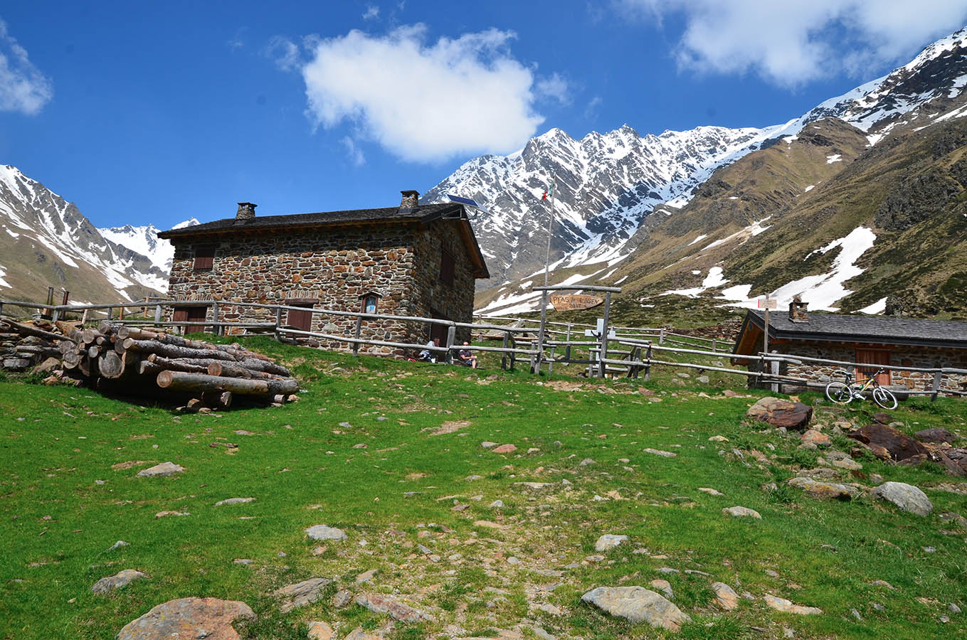
Point of arrival: Rifugio Saverio Occhi hut, altitude 2047 m
Length: 21 km
Difference in height: 925 m
Type of bicycle required: mountain bike
Difficulty: EASY
