Monte Guglielmo is one of the most popular mountains in the whole prov- ince of Brescia all year round, for the variety of routes and the open views it offers. You can reach its top by hiking and also by mountain biking.
The most popular bike route is the one which follows the road starting from Croce di Marone, a place that can be reached through the provincial road which connects Marone to Zone along Valle di Gasso.
Ascend by car to Zone and reach Cislano, where you park at the fork and follow the road on the right, at the beginning of which you find the sign for Monte Guglielmo. In the first section, on the opposite side of the valley you can admire the rocky Corni Stretti mountain, while the sus- pended carts to Marone leave from the nearby Calarusso quarry. The ride is quite hard not only because of the incline, but also for some uneven sections of the road. You can nevertheless still ride the whole length of the route.
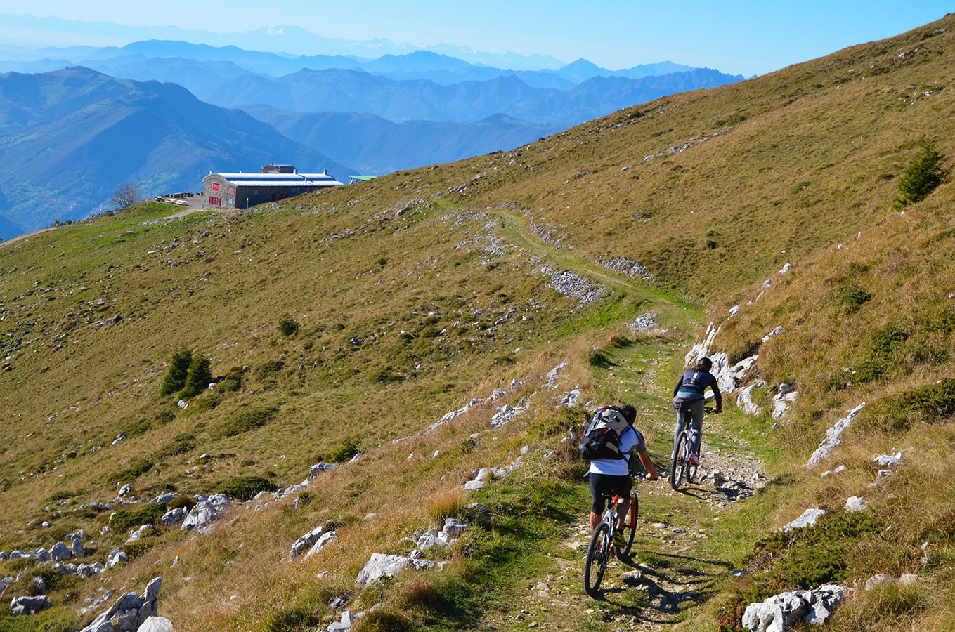
To reach Passo Croce di Marone, you have to climb until you merge onto the road which rises from Valle dell’Opolo and continue left for a short distance. At Pas- so Croce di Marone, you are almost half way to Monte Guglielmo and the direction to follow is well marked. You continue on the road and pass by Rifugio Malpensata hut, after which you enter into Val d’Inzi- no, one of Val Trompia’s right side valleys. The paved road climbs without any major challenges until it reaches Malga Gugliel- mo di Sotto cowshed and after a couple of kilometres Malga Guglielmo di Sopra cowshed, where you find an information board about the “Malghe in rete” (Cow- shed network) project.
This is where the effort significantly increases, first on the very steep section which leads to Rifugio Almici hut, then on the section which leads directly to the nearby Cristo Redentore (Christ the Re- deemer) monument at the top. The final part is bumpy and you will need to push your mountain bike by hand. The descent follows the same route.
Point of departure: Cislano di Zone, fork for Val di Gasso, altitude 618m
Point of arrival: Monte Guglielmo, altitude 1948m
Length: 14 km
Difference in height: 1330 m
Type of bicycle required: mountain bike
Difficulty: EASY
